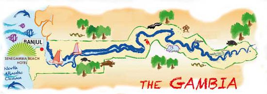
Gambia Dez. 2012
Ich habe keine alllzu grosse Vorstellung davon, was mich in diesem Land erwartet.
Die Entscheidung zu dieser Reise ist Anfang Oktober gefallen, und die Plus-Punkte, die zur Buchung geführt haben, sind schnell aufgezählt:
- relativ kurzer Flug
- Temperatur am Zielort (es ist heiss!) :-D
- Landessprache Englisch
- Steinkreise von Wassu
- Bootstour auf dem Gambia-River
Facts about the Gambia

Auszug aus der Homepage von Senegambia Beach Hotel
Official Country Name: Republic of The Gambia
Capital City: Banjul
Gambia's Location: Western Africa, bordering the Atlantic Ocean and Senegal
Geographic Coordinates: 13 28N, 16 34 W
Coastline & Area:80 km and area of 11,300 square km
Climate: sub-tropical climate with two distinct dry & rainy Season's annual rainfall:1,296 millimeters
Administrative divisions: 5 divisions & 1 city: Banjul, Lower river, Central river, Upper river, North bank and Western division
Country dialing code: +220
Currency: D1=100B
Defense: Expenditure: 0.5%(2006) OF GDP, no conscription
Government Office Hours: 8am to 4pm, Friday's half-day
GDP ppp: GDP per capita ppp $1,200-GDP2008)$2.044 billion
Independence Day: February 18th(1965) from Britain
Internet Domain: .gm
Land Area: 10,000sq km + water=11,295 sq km
Land Boundaries: 740 km
Main Exports: Groundnuts, fish and palm kernels
Main Service Industry: Tourism
Languages: Fula, Mandinika, Jola, Wolof&Serahuli, other indigenous vernaculars
Ethnic Groups: African 99%(Mandinika 42%, Fula 18%, Wolof 16%, Jola 10%, Serahuli 9%, other 4%) non-African 1%
Population:1,735,464(July 2008 est.)
Population growth rate: 2.724% per annum(2008 est)
Official language: English
Religion: Muslim 90%, Christian 9%, others 1 %
Time Zone: GMT
Voltage: 220-240V, 50 Hz Weights & Measures: Metric Units
| Aufbruch: | 21.12.2012 |
| Dauer: | 13 Tage |
| Heimkehr: | 02.01.2013 |
